Refresher for the Beginner and Professional
West Midlands
Complimentary Topics:
Insurance Cover
Law Menu
Pages


Everything For The Metal Detectorist - Technology

The Paragon Of Metal Detecting
Powered By Sispro1
Copyright All Rights Reserved by Nigel G Wilcox E-Mail: ngwilcox100@gmail.com
Designed by Nigel G Wilcox
Member NCMD
Metal Detectorists - Technology Used Revolutionising Archaeology


Six tools that are revolutionising archaeology by helping us find sites without digging
In the past decade there has been a quiet revolution in archaeology, virtually allowing archaeologists to see through the ground without digging. Advances in geophysics, soil chemistry and remote sensing are speeding up the discovery of ancient sites and helping archaeologists understand them on a global scale.
Below is our list of the top six of these techniques. While each is valuable on its own, the future will lie in combining them – possibly one day creating a GPS-linked virtual reality that will take the observer below the ground.
While you won’t find actual artefacts in this way, and cannot date what you see, this approach is much more sustainable than actually digging and possibly risking damaging objects. Instead, it leaves the buried archaeology for future generations when techniques of excavation might be even better.
Satellite imagery such as Google Earth, Microsoft’s Bing and Nasa’s World Wind has made it possible to zoom into even the most remote corners of the globe to locate sites. By helping to spot things like settlement mounds or enclosures, it can help draw attention to places where such sites may be found. Aerial photographs have been used in this way since the 1930s, but these were typically difficult to access. The universal availability of Google Earth has therefore made it a fantastic tool for professional and citizen scientists alike. However there are many pitfalls in interpretation of satellite images that can only be resolved on the ground.
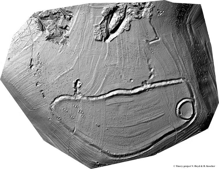
Image of the Late Hallstatt princely hillfort, c. 550-450 BC, covered nowadays in dense wood. Tincry project V. Heyd & B. Koscher, Author provided
2. LIDAR
Archaeological sites often leave surface traces of what is buried beneath the soil. We have long laboured in manually mapping elusive “humps and bumps” often using hachures, a form of representation invented in 1799. Now Light Detection and Ranging (LIDAR) technology produces detailed three-dimensional maps of the Earth’s surface in a fraction of the time. In principle working like a table scanner but operated from a plane, laser beams are directed to the ground, while connected to an accurate GPS and an inertia measurement system, generating a point cloud image of the ground surface. One advantage of LIDAR is that it can often see through vegetation, locating sites otherwise obscured by woodland or tropical forests.
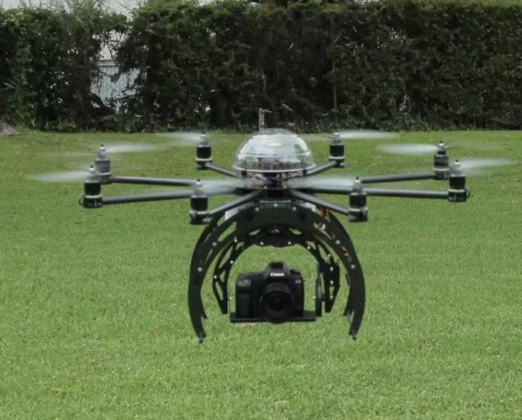
Drone taking aerial images. Flying Eye/wikimedia, CC BY-SA
1. Google Earth
3. Drones
Archaeologists have been using drones for a number of years to capture sites from the air. Before that, we used a variety of homemade kites, helium balloons and model planes – filling the gap between aerial photographs and images taken from the top of Landrovers and shaky ladders. Drones can take photographs in low light and in frost and snow conditions when the archaeology can better visualised. One particular application is to mimic LIDAR, by taking overlapping vertical images, and with ground control (typically paper plates at fixed points) it is possible to generate three-dimensional point cloud imagery, using standard software packages. In the not too distant future it will be possible to mount LIDAR directly onto drones.
Using Technology to Make Finds