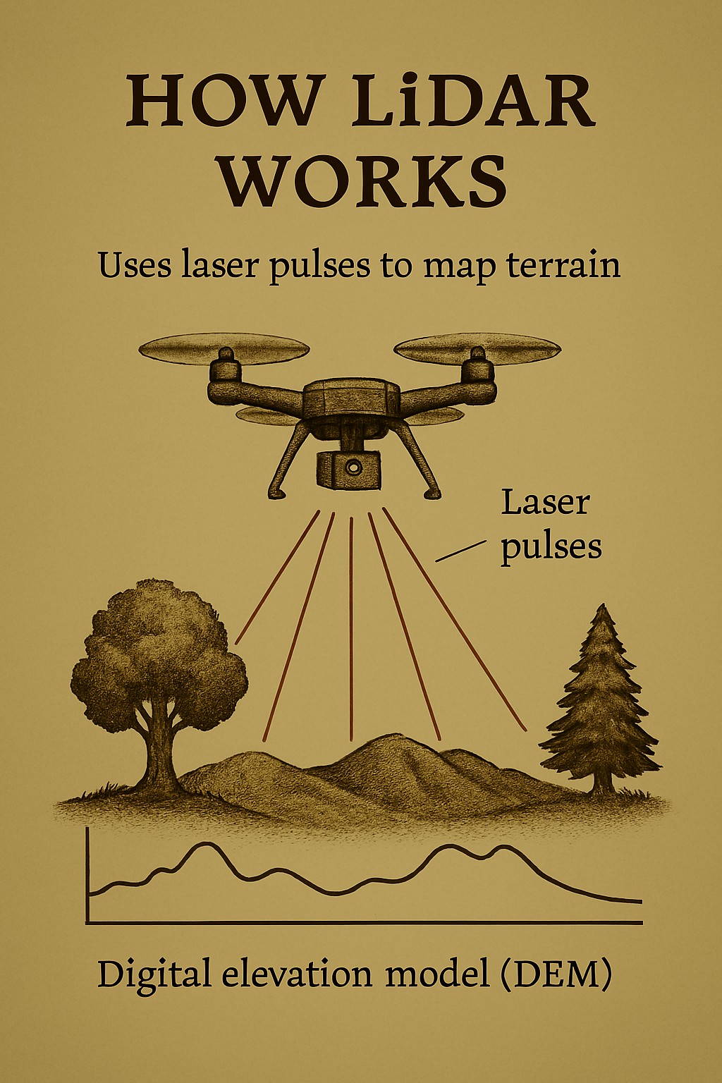
Battlefield archaeology: LiDAR mapped terrain, detectors traced bullet scatter and troop movements. The time it takes for each pulse to return is measured to calculate distance.
Millions of these data points are processed into Digital Elevation Models (DEMs) or 3D terrain maps.
Applications in Archaeology Mapping Hidden Landscapes: Reveals ancient roads, settlements, and agricultural systems obscured by vegetation.
Identifying Features: Detects subtle topographic changes like mounds, ditches, and walls.
Planning Excavations: Helps archaeologists prioritise dig sites and reduce unnecessary land disturbance. Preserving Sites: Enables non-invasive surveying, protecting fragile or sacred locations.
Notable Discoveries Maya Civilization: LiDAR uncovered thousands of previously unknown structures in Guatemala and Mexico, reshaping our understanding of Maya urban planning.
Angkor Wat: Revealed vast networks of roads and canals around the temple complex, offering insights into Khmer infrastructure.
LiDAR doesn’t detect artefacts directly, however; it maps the land. But when paired with tools like metal detectors, it becomes part of a powerful toolkit for ethical, efficient archaeological exploration.